In order to conduct a geophysical survey of the subsurface you need to have correct location information at the surface. The purpose of a land survey is to provide that surface control to hang your geophysical survey on.
Our refraction and resistivity surveys are going to be on Peniel Farm, in order to determine depth to bedrock along the ridge near the Gazebo. Imagine the univeristy is the client and they want to build a building there. What they want us to determine is what they will encounter when they start excavating. So the tasks today are twofold.
1) We are going to inspec the area for any evidence of rock at the surface. Make note of it, and make a sketch in your field notebook. This will guide where do the geophysical surveying later, and the land surveying now.
2) Collect the land survey data. You are going to work in 3 groups of 2, and each group will collect essentially identical data, hopefully today, but if not we will finish next week.
These data include:
Surveying of Ground Control Points using a Total Station
Surveying of these
as well with a Differential GPS requires some processing
Acquisition of georeferenced photos with a UAV
The above link give details on how to process these data that you have acquired. If you learn better with videos here is one on how to use the program Metashape as well as one on photogrammetry processing steps.
Note make a sketch of the entire area including labeling of where you put ground control points.
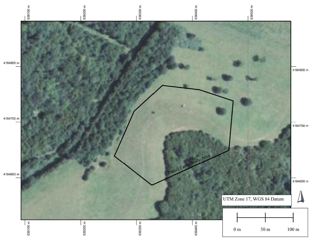
Our focus for the first lab is on acquisition. Your group can certainly begin processing, but for Wed. class I want you to make a simple 1:2000 base map of the area like is displayed below, and print it out. Note, the one shown below is a screen dump so while the graphical scale is correct, it is not necessarily 1:2000. Make sure your print out is to that scale. This is something that you always want to be mindful of: people still want hardcopy, and they want convenient scales.
You are going to make the map in Global Mapper, not ArcGIS. The reason for this is that if you know ArcGIS then you will be learning an additional, and in most ways better GIS, by using Global Mapper. If you don't know ArcGIS, then by all means just learn the superior Global Mapper :) My FAQ on Global Mapper goes through the basics. But it is so easy to use that I suspect you could figure it out on your own. It is installed on the Geo Lab machines.
Map data to load is in the class folder R:\courses\GEOL 275-Geophysics 2020\Lex_Quad_GlobalMapper, but you can also download data like the NAIP airphoto shown above, from within the program.