Getting Started with ArcGIS
ArcGIS software that runs a GIS (Geographic Information System). A GIS accesses a spatial database to manipulate maps, images, and other geo-located data (such as topography, rainfall data, anything that has location associated with it). We are going to do a VERY brief introduction to this topic. If you want to learn more about GIS take the course GIS and Remote Sensing, Geo 260, offered every winter term.....
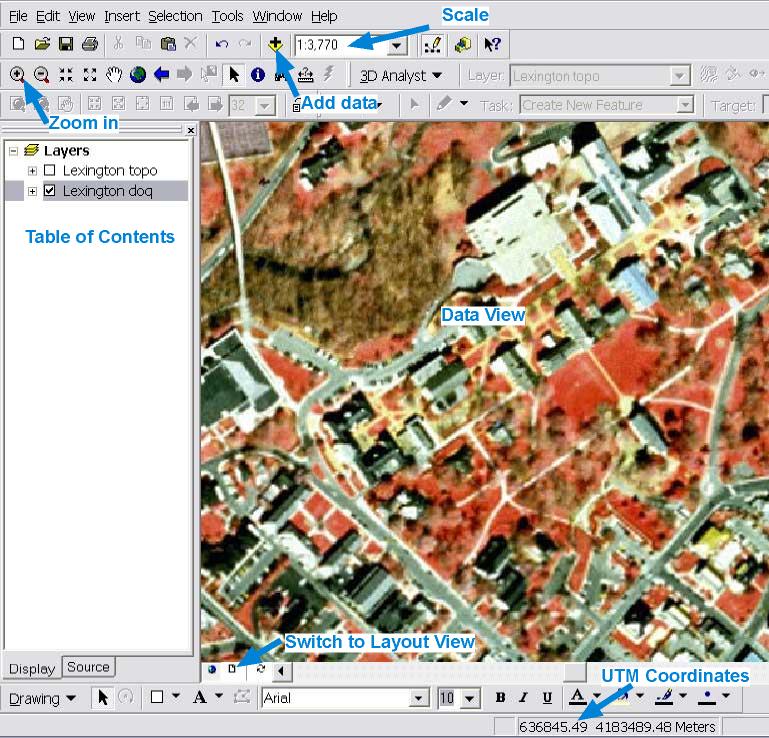
ArcMap is one of many programs in ArcGIS, but is the one you will probably use most. It allows you to:
You can start ArcMap by going to Start Menu -> ArcGis ->ArcMap
ArcMap Opening Window
There is a lot to this program, but basically ArcMap allows you to see maps in the Data View, and decide what to view by checking the check box of those items you want to see in the Table of Contents.
If you ever do not see the an object after checking then right click the item and select Zoom to Layer.
If you want to change the properties of an item, right click the item and select Properties.
If you want to zoom in use the magnifying glass.
Coordinates, such as UTM coords. are at the bottom right.
Adding Data
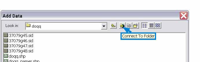
If you want to add more data select the + symbol with the yellow diamond behind it (see figure above).
Note you will sometimes not see the folder you want in the pull down list, if this happens, then click the "Connect To Folder" icon and add the drive where your folder resides (e. g. your H drive?). The drive will now show up in the pull down list and and you can add the folder
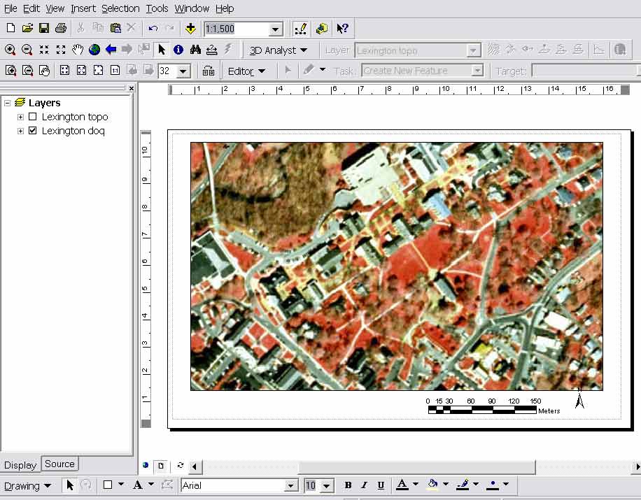
ArcMap Layout View
If you want to print something switch to the Layout View by clicking the page icon at the bottom of the Window.
Then you can add an arrow and scale from the Insert Menu.
Connors, 04