Topography, or the shape of the Earth's surface, is mapped and displayed on topographical maps. Contour lines, or lines which connect points of equal elevation, are drawn on a topographical map in order to quantify the elevation at any point on the map.
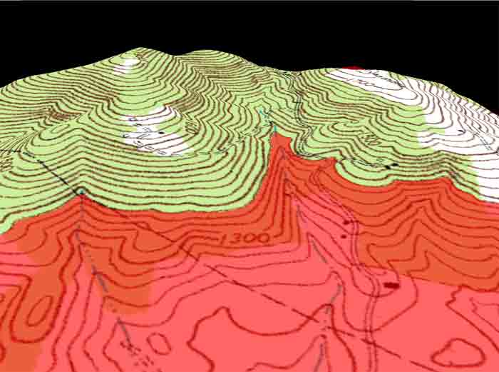
Where contour lines are spaced closely together (A) it means that the topography is very steep. Where the lines are spaced farther apart (B) it means that the terrain is more gently sloping.
In the image below a horizontal plane has been inserted into the three-dimensional representation of the above topographical map. The intersection of the red horizontal plane and the topographical map is the 1380ft contour. The contour interval, or vertical elevation between each contour line, is 20ft for this map. Notice the contour line just above the intersection of the red surface and map. This darker contour line is the 1400ft contour and is called the index contour. Index contours are spaced at regular intervals and are useful in visualy determing the contour interval.
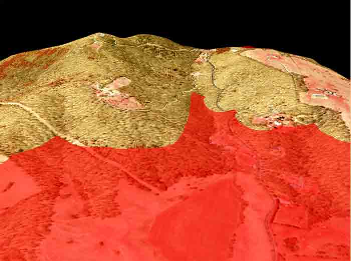
Below is an image taken at the same perspective as the one just above. This orthorectified aerial photograph is displayed with the red horizontal plane. The horiztonal plane is still set at 1380ft.