Stratigraphic Column Assignment
Due Wed Apr 5th at start of class.
Draw a stratigraphic column of our area. That is, an ordered arrangement of the rock layers by age relationships. You will use the data you have collected from the stops from your field trips. This column should include stop #, geologic period, age (as a range in years before present based on the period), formation name, general rocks found and their environment of deposition (only for sedimentary rocks), and resistance to weathering, ignore stratigraphic thicknesses.
You show resistance to weathering by showing the steepness (or gradualness) of the slope of the unit diagrammatically.
For environment of deposition, make a column that shows onshore on the left and offshore on the right and shoreline in the middle. For each sedimentary rock formation, show where the formation lies on this continuum.
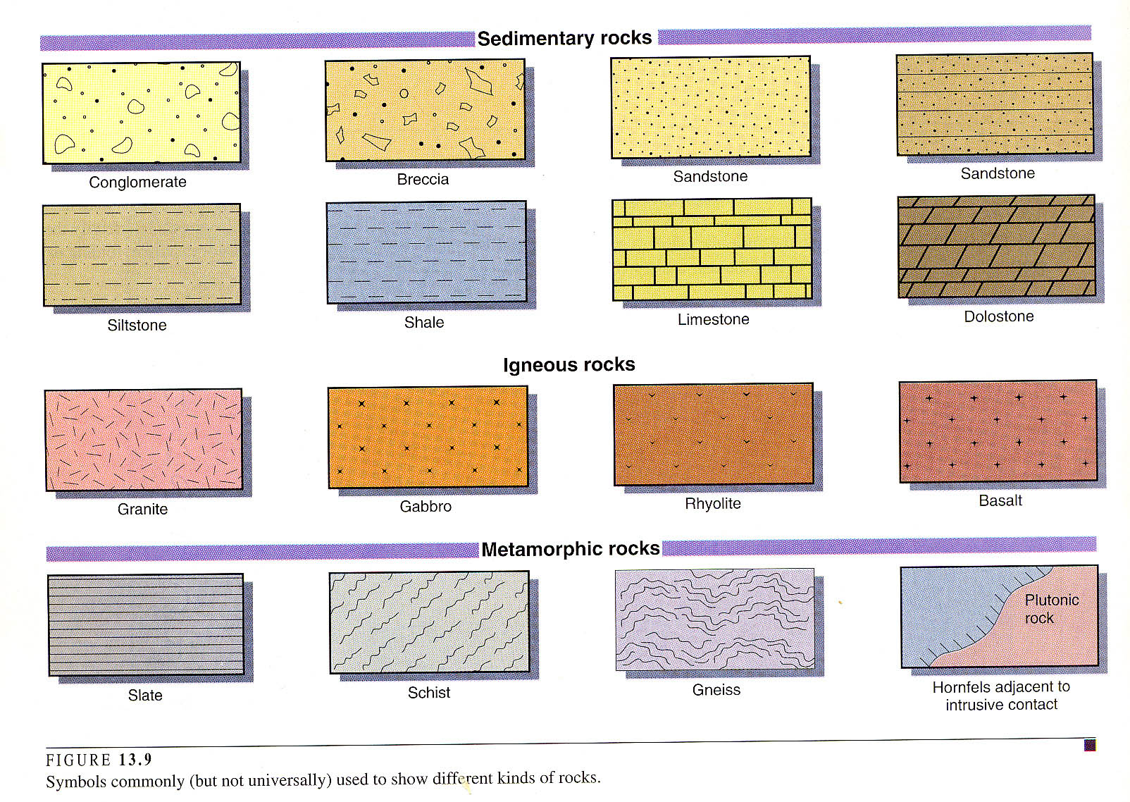
To show the kinds of rocks in a formation, use the symbols (patterns) for different rocks as shown on the next page (don’t worry about color if you don’t want to).
Inside the pattern use the abbreviation label with a capital letter for the geologic period and lowercase letters for the formation name, like we have done in our notes.
You can draw this onone piece of paper and I would do it along the wider part of the paper (landscape orientation). To get a feel for what a strat. col. should look like see the one for the Grand Canyon in your text (note this does not show the depositional environment that I also want, nor does it have all the labels I ask for here). When depicting timing relationships remember that igneous and metamorphic rocks don't get laid down one on top of another, like sedimentary rocks. So, in your column for ign. and mm. rocks you want to show cross-cutting drawings and features to show the timing relationships, and you label those within the sketch.
Unless there is an unconformity present, the line that separates each formation can be a straight line. For unconformities, the line should be an irregular line. There is a geologic time scale in your text, as well as on the side of the topo map you have. A well-done stratigraphic column is part art, part science, and is a tremendous way to summarize the geology of an area. So, the presentation of the data really matters. It is more than just making a table of names. The first thing a geologist usually wants to see when he comes to a new area is the strat. col., then the geologic map.
You are not to use web resources, or other students notes, for this strat. col. This should be based on the notes you have taken in the field. If you missed a lab, then you can get info from a fellow student only for that lab. You are allowed and should use your topo map that you have been recording the stops.