There are plenty of ways of doing this depending on the programs and the GPS units you are using. Here are two ways:
Using AVGarmin
This is an old workflow we developed to get GPS points into ArcGIS using:
* a shareware program called Waypoint+
* a user-reated Arcview extension called AVGarmin
I do not recommend it if you have the MapSource program (which we have here at W&L Geology). So we focus here on the second workflow.
Using MapSource
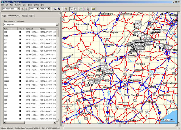
This brief tutorial is based on MapSource 3.9. The version that is currently on the geology computer lab machines. Newer versions exist, but for what we want to do here, this will serve our purpose just fine.
MapSource is program written by Garmin, the company that makes our GPS devices. MapSource allows you upload, download, and modify waypoints, tracks, etc., as well as download maps to the GPS unit.
Steps to download GPS points from the unit into ArcGIS by going through GlobalMapper.
1. Connect the GPS unit to the computer using the communications cable (get these from the same place you get the GPS units).
2. In MapSource, go to Transfer >Receive From Device. In the dialog box that comes up check “Waypoints” only (uncheck the others). The points should show up on the screen.
3. To save them to a file choose File>Export. Choose the .gpx file format which is a general GPS file exchange format.
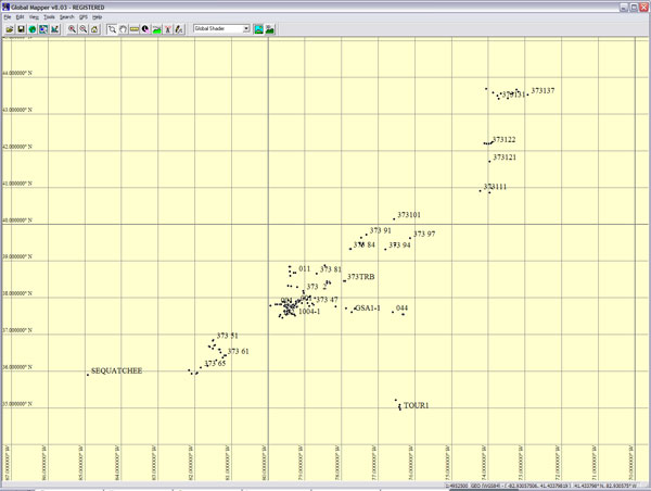
4. No matter what other programs you want to use of these in, import them directly into GlobalMapper first by choosing File>Open Data File or drag the file over an open GlobalMapper window. Export the points as a shapefile (.shp extension) by choosing File>Export Vector Data>Export ShapeFile.. Shapefiles are general vector GIS files used by many programs.
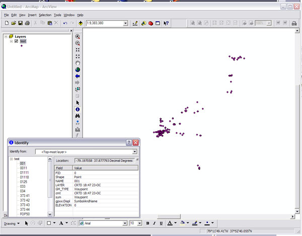
5. To get them into ArcGIS, choose Add Data or click the yellow “+” symbol. See the ArcGIS turtorial if you forget.
Connors, 07